Contents
What is the news?
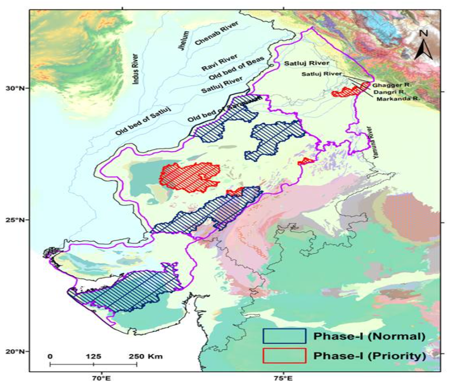
The Central Ground Water Board, Ministry of Jal Shakti and CSIR-NGRI (National Geophysical Research Institute), Hyderabad have signed an agreement for use of advanced heli-borne geophysical survey and other scientific studies in Arid Regions.
About the Heli-Borne Survey

The Heli-Borne Survey aims to conduct High-resolution aquifer mapping using heliborne geophysical studies. It includes studies such as identification of Sites for artificial recharge, 3D Geophysical model, Geophysical Thematic maps, Aquifer system with relatively fresh and saline zones. The study will provide a high-resolution 3D image of the sub-surface up to a depth of 500 meters below the ground.
The survey also aims to map the Spatial and depth-wise distribution of the paleochannel networks if any and their linkage with the aquifer systems.
The survey regions include parts of the States of Rajasthan, Gujarat, Haryana, Punjab, and Himachal Pradesh covering an area of 3.88 lac sq. km under the Aquifer Mapping Programme.
The expected outcome includes selecting suitable sites for groundwater withdrawal and water conservation through artificial or managed aquifer recharge.
What is the importance of the project?
Arid areas in North-Western India spread over parts of the States of Rajasthan, Gujarat, Haryana and Punjab. The annual rainfall is in the range of less than 100 to 400 mm.
But, this region covers nearly 12% of the total geographical area of the country and are home to more than 8 crore people. So, this area faces an acute shortage of water throughout the year.
The High-Resolution Aquifer Mapping & Management in Arid Regions of North-Western India project will benefit millions of people across the region and positively contribute to “Har Ghar Nal Se Jal” as well as “doubling farmers income” goals.
What is the National Aquifer Mapping and Management Programme(NAQUIM)?
It was launched in 2012 by the Ministry of Water Resources(now Ministry of Jal Shakti). Central Ground Water Board(CGWB) is implementing the NAQUIM for aquifer mapping in the country.
The program aims to identify and map aquifers at the micro level to quantify the available groundwater resources. It also aims to promote participatory groundwater management.
| Read more: National Aquifer Mapping and Management Programme(NAQUIM) |
Terms to know:
Source: This post is based on the article “Shri Gajendra Singh Shekhawat & Dr. Jitendra Singh To Jointly Inaugurate Heli-Borne Survey For Ground Water Management In Arid Regions” published in PIB on 4th October 2021.
Discover more from Free UPSC IAS Preparation Syllabus and Materials For Aspirants
Subscribe to get the latest posts sent to your email.


