

ForumIAS LATEST
- 08 June | Sociology Optional Strategy Session with AIR 10 Ujjwal Priyank Click Here to register →
- 08 June | Geography Optional Strategy Session with AIR 39 Rohin Kumar Click Here to register →
- 09 June | Ethics+ Class #1 + Case Studies Workshop by Mr. Ayush Sinha | Click Here to register →
News: United States National Aeronautics and Space Administration(NASA) has captured images depicting the wet and dry cycles of Etosha Pan in Africa.
Facts:
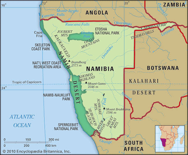
- Etosha Pan: It is a large endorheic salt pan forming part of the Kalahari Basin in the north of Namibia.The pan is mostly dry but after a heavy rain, it will acquire a thin layer of water which is heavily salted by the mineral deposits on the surface.
- Protection: It is protected as part of Etosha National Park, Namibia’s second-largest wildlife park.It is also designated as a Ramsar wetland of international importance.
Additional Facts:
- Endorheic Basin: It is a closed drainage basin that retains water and allows no outflow to other external bodies of water such as rivers or oceans but converges instead into lakes or swamps, permanent or seasonal, that equilibrate through evaporation.

